This weekend we move our clocks ahead one hour for Daylight Saving Time. However, weather-wise we will be taking a step back. Another shot of arctic air returns this weekend and we are also watching the threat of a late season snowstorm. There is still a lot of uncertainty with this storm since we are still several days away. But first, our milder midweek.
Milder air will begin to move into our area as strong southerly winds increase during the day on Tuesday. Temperatures along the coast will stay cooler (in the low 50s), and temperatures inland will climb into the low 60s.
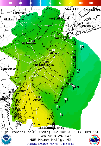 Tuesday High Temperatures.
There will be a good deal of cloud cover on Tuesday with rain moving in ahead of a cold front Tuesday night. The best chance of rain will occur overnight and especially early Wednesday morning. Rain should be over by 8am.
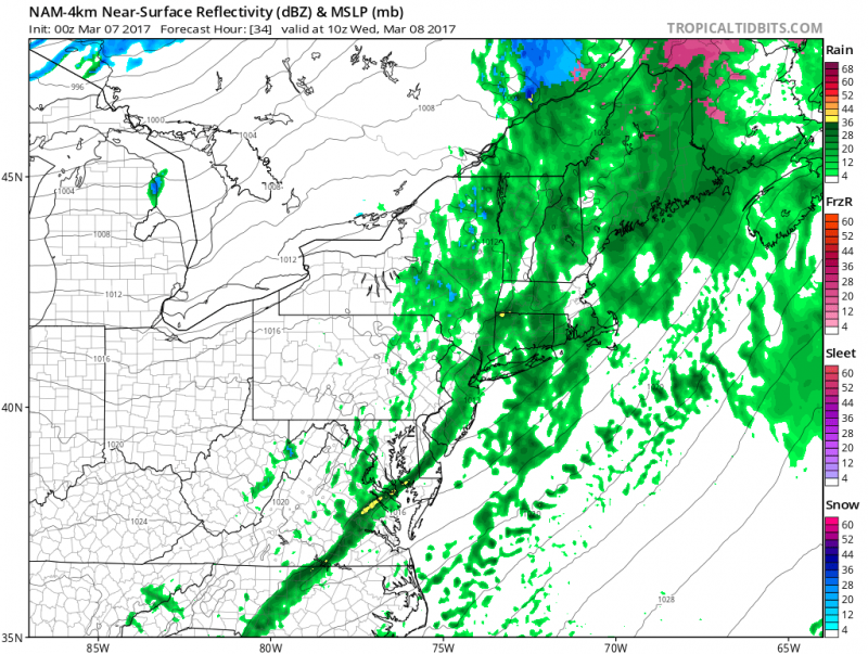 Showers along the front move through early Wednesday morning. (Courtesy:tropicaltidbits.com)
Sunshine returns during the day on Wednesday and it will be breezy as winds shift westerly behind the front. The good news is that will push temperatures along the coast to around 60.
Thursday will be another sunny day but northwest winds will be busy…15-20mph with gust to 30mph. Temperatures will be a little cooler (in the low 50s).
Friday a weak disturbance moves through which could bring a period of rain and maybe even some flakes as colder air begins to filter in.
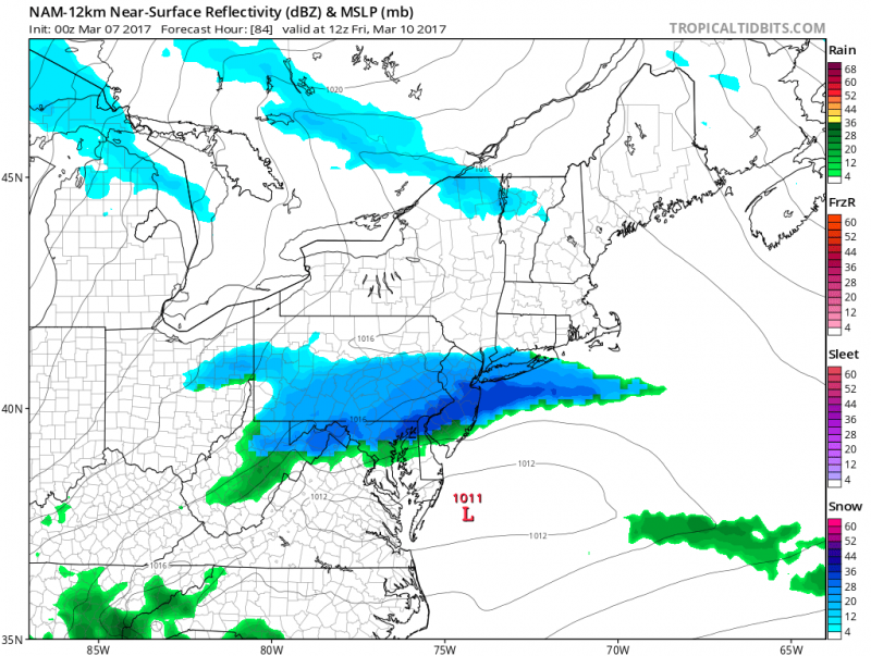 First weak low moves through on Friday with a period of rain/flakes possible (Courtesy: tropicaltibits.com)
A more significant low pressure system could develop this weekend, but models do not have a handle on the exact track. While enough cold air could be in place to ensure any precipitation would fall as snow, the deeper the cold air is entrenched along the Northeast U.S. could determine how much snow we might see.
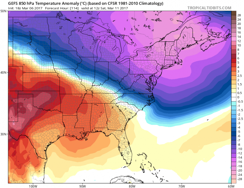 Some models indicate that a strong pool of arctic air will anchor itself across New England which would be enough to suppress the storm track which would result in less snow or maybe even no snow at all.
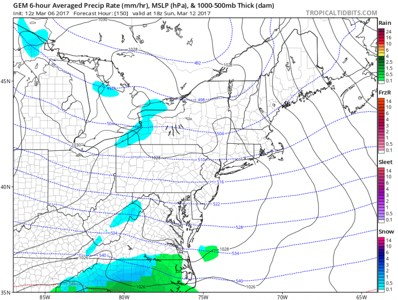 Canadian model shows track further south resulting in a dry weekend. (Courtesy:tropicaltidbits.com)
If the cold pool is not as strong, the storm will track closer to us which would result in a more significant dose of snow or a snow/mix/rain event for Sunday.
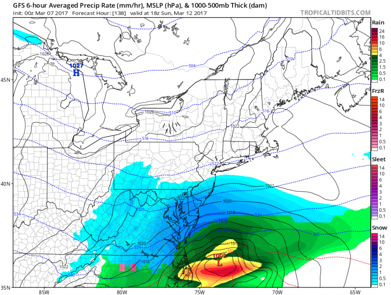
American model shows a closer track resulting accumulating snow on Sunday. (Courtesy:tropicaltibits.com)
We will continue to update you as we move closer to the event.


