
The coldest air since early January has moved into our area. Despite the sunshine, brisk northwest winds 15-20mph will keep temperatures in the mid 30s with wind chills in the low 20s. Winds will ease a bit tonight and skies will be clear. This will allow temperatures will plummet into the teens.
 Sunday Morning lows
Winds will be lighter on Sunday but temperatures will notch only a few degrees higher then Saturday (upper 30s) with plenty of sunshine.

Sunday Highs
The freeze will ease a bit on Monday as temperatures rebound back to seasonable levels (mid to upper 40s). A mild surge returns for Tuesday as south-southwesterly winds will push mainland temperatures into the low 60s but keep the coast in the 50s.
 Forecast for Tuesday shows temperatures in the 60s inland and mid 50s along the coast.
The next chance of rain will be Tuesday night as a front pushes east.
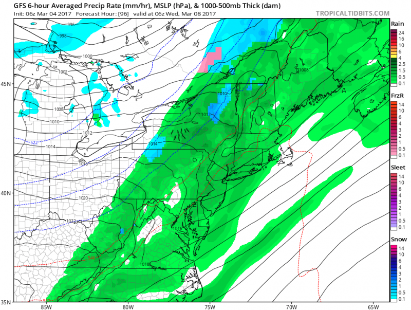 Computer models show rain moving in Tuesday night after 7pm and ending by sunrise Wednesday. (courtesy: tropicaltidbits.com)
Wednesday will feature a return to sunshine, breezy conditions but still mild with temperatures in the upper 50s. Cooler, drier conditions return for the second half of the week and into next weekend as temperatures drop back to more seasonable levels (upper 40s-low 50s).


