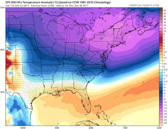
Christmas is almost here and even though we aren’t expecting a white Christmas, a fairly stormy pattern is setting up coupled with very cold air that will be locked into our area Christmas week. This could spell a threat of some wintry weather before the year is out.
First, a storm system will be moving in for the first half of the weekend. Temperatures will be flirting near 60 on Saturday, so occasional rain is expected to damper any last minute shoppers. The best chance of getting wet could be in the morning and again in the late afternoon and evening hours.
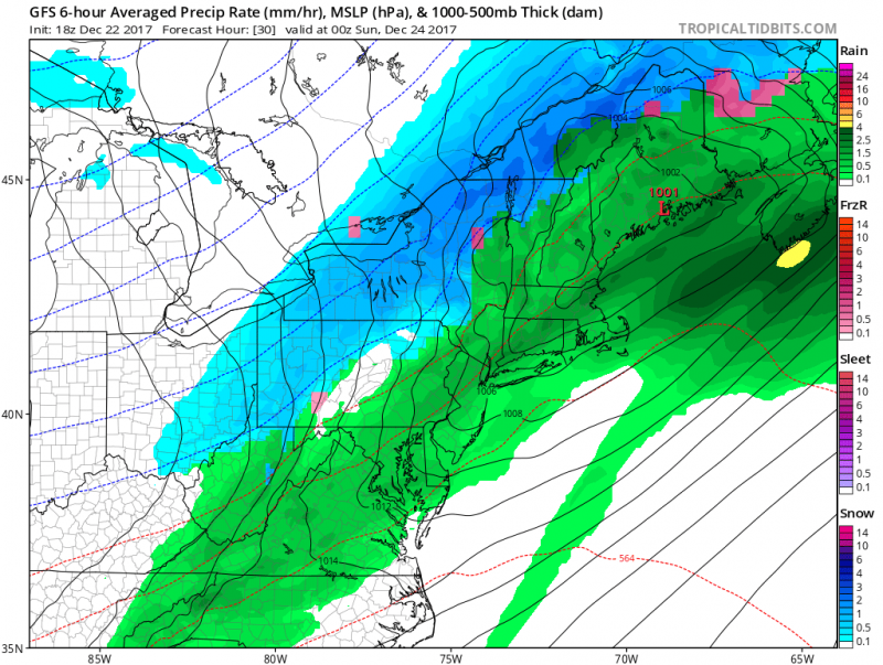
Chillier air will spill in behind the first storm system and skies will clear for a time on Christmas Eve as High Pressure briefly moves into our area. High temperatures on Christmas Eve will be in the mid 40s.
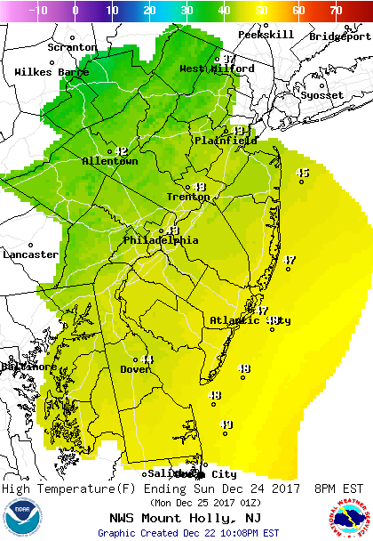
Forecast highs Christmas Eve.
Christmas Eve night the next storm system will approach the area. In Addition, colder air will be moving behind it. For us just a brief shot of some light rain. But as the storm pulls away and deepens over New England, it will be cold enough for some snow mainly N&W of Philadelphia and into Northern NJ.
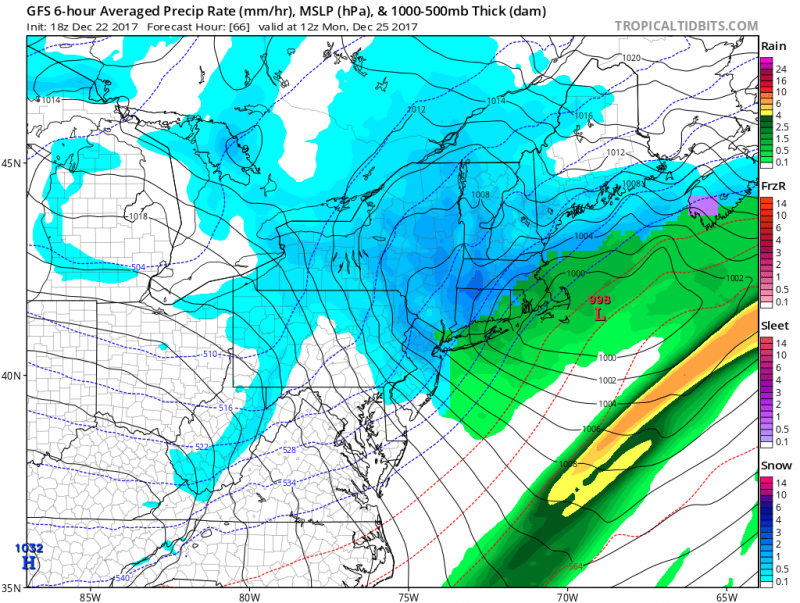
Computer models show areas to our N&W ending as snow as storm moves away. (Courtesy:tropicaltidbits.com)
The best chance for seeing some accumulating snow on Christmas morning will be well north and west of the area. (Eastern PA and Central and Northern NJ)
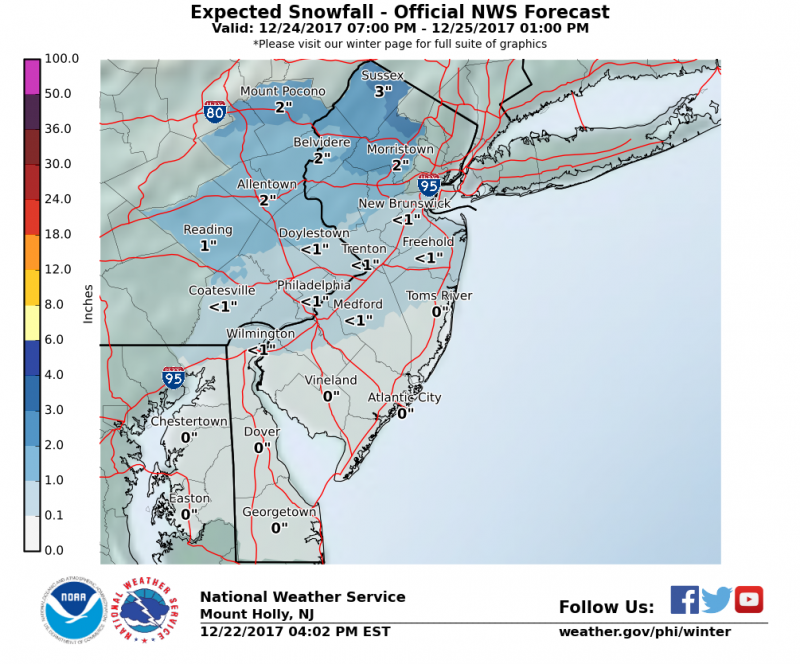
Snow total forecast by Christmas morning.
Christmas Day will be windy and colder. Highs will be around 40 degrees but cold northwest winds gusting to 30mph will make it feel like its in the low 30s. The coldest air of the season settles in for the remainder of the week as highs will remain in the 30s and lows will dip into the low 20s.
With cold air in place, another storm system bears watching as we head towards next Friday. We are still several days away, but the chances of a significant winter storm for the Northeast is increasing.
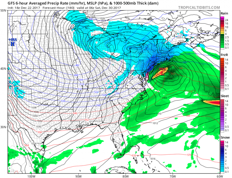 One of the computer model solutions show the threat of a winter storm that could threaten our area next Friday. This scenario would be snow to rain along the coast with significant accumulations across interior New Jersey and Eastern PA. Reminder….any deviation of the track and strength would change this putcome. Will have a better handle as we move into the middle of next week.(Courtesy:tropicaltidbits.com)
RECAP:
1st Storm- Saturday- occasional rain especially in AM and late afternoon/evening hours.
2nd Storm-Christmas Eve night ending before sunrise Christmas morning- brief shot of light rain.
3rd Storm-Next Friday- Chance of Snow And/or Rain.
Merry Christmas!

