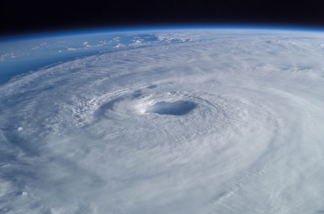
We have officially entered the 2017 Hurricane Season and there is still uncertainty whether or not we will have a active year. While hurricanes typically don’t threaten our area until late summer and fall, it always important to be prepared.
Several forecasts have been issued and it shows that an average to above normal season is possible. In case you missed it, we have already had one named storm. Tropical Storm Arlene made a brief appearance in the Atlantic back in April.
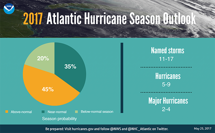
NOAA predicts a 45% chance of an above normal hurricane season with 11-17 named storms, 5-9 hurricanes and 2-4 major hurricanes. (Courtesy: NOAA)
Of course, several factors are still in question on whether the forecasts will verify. One factor is El Nino. There has been uncertainty on the development of El Nino emerging this summer. El Nino is a result of warmer than normal temperatures along the Pacific equator which can affect the weather on a Global scale. So you might ask, how will this affect Ocean City during this year Hurricane season?
El Nino is known to stifle the formation of developing tropical systems in the Atlantic Ocean due to upper level westerly winds shearing the systems apart when they form. However, latest forecasts indicate that El Nino may fail to develop, which would allow tropical systems to thrive.
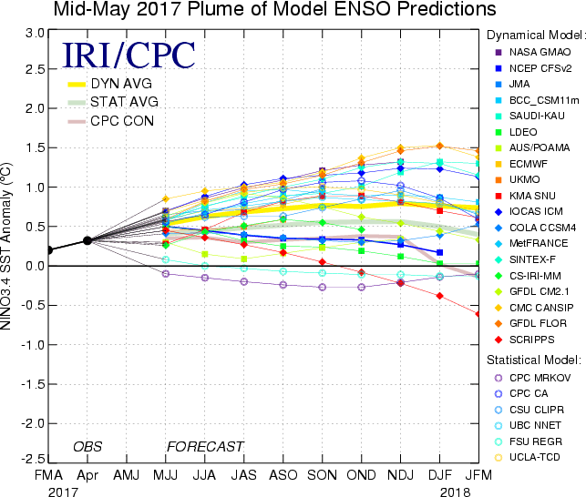 Latest forecasts show a weak El Nino is possible but less of a chance of a moderate to strong El Nino forming.
Another factor which is important to tropical development is sea surface temperatures. Looking at current ocean temperatures across the Atlantic, Carribean and Gulf of Mexico shows that temperatures are already at or above 80 degrees which is enough to support tropical development.
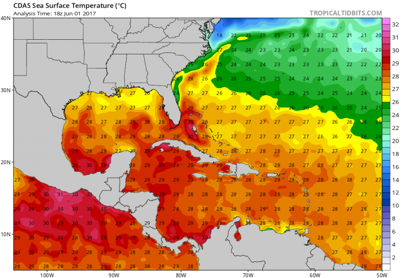 Current Sea surface temperatures (Courtesy:tropicaltidbits.com)
As I have already mentioned, the threat of any tropical storms or hurricanes really don’t impact our area until late August through September. Only recent storms to affect our area outside of that time frame was Hurricane Arthur, which moved up the coast over the July 4th weekend in 2014 and Superstorm Sandy in late October 2012.
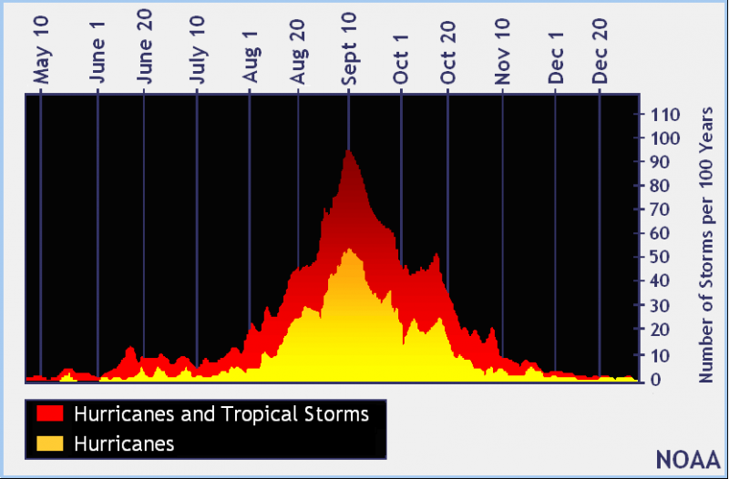 Graph shows the total amount of named storms over the last 100 years with the highest amount peaking during the 2nd week of September. NOAA
The U.S. coastline has not been hit with a Major Hurricane in over 11 years (Hurricane Wilma-2005). This does not mean there was a lack of major hurricanes in the Atlantic. Steering currents in the upper atmosphere guided these storms stay away from the U.S. When a trough sets up over the Eastern U.S. approaching hurricanes are picked up and pushed out to sea. However, there are times when a blocking pattern sets up and can capture a storm and pull it towards the coast, like Superstorm Sandy. Ocean temperatures and our geographical location make it difficult for major hurricanes to affect Ocean City. Hurricanes need to 80+ degree water to maintain its strength. Also, wind shear is much stronger at our latitude which weakens hurricanes. But it is important to know, the strength of a hurricane which is determined by its maximum wind speed isn’t as important as its impacts. Storm surge and tidal flooding has been the major impacts of any hurricane or coastal storm that has affected Ocean City.
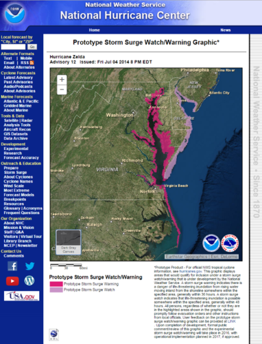
A new feature that will be issued by the National Hurricane Center is the Storm Surge Watch & Warning. This product will forecast the potential storm surge along the coastline as a hurricane threatens the coast. This feature was developed thanks to Superstorm Sandy when a weakening storm (as far as wind strength) did not accurately represent the real severe impact of the storm.
In conclusion, we can expect at least an average season to potential above average hurricane season. The average would be 12 named storms (39-73mph), 6 hurricanes (74mph+) and 3 major hurricanes (111mph+). Remember, whether its an active or inactive season, it only takes one storm. So be prepared!

