A Winter Storm Warning is in effect for Cape May & Atlantic Counties for Saturday.
Get ready for a significant coastal snowstorm to affect our area on Saturday. Models have generally come into agreement that the storm track that was once supposed to stay to our south and give us a brush with some snow has now inched closer to us. As a result, Snow amounts forecast from this morning have increased a bit. With temperatures in the 20s, snow will accumulate easily on roads and sidewalks. Snow will become heavy at times on Saturday with near-blizzard like conditions as winds will increase out of the north 20-25mph with gusts to 30mph+. Hazardous travel is expected especially during the late morning and early afternoon as the highest snowfall rates occur. Travel will be troublesome even after the storm ends by late afternoon and into the night as winds will cause blowing and drifting of snow.
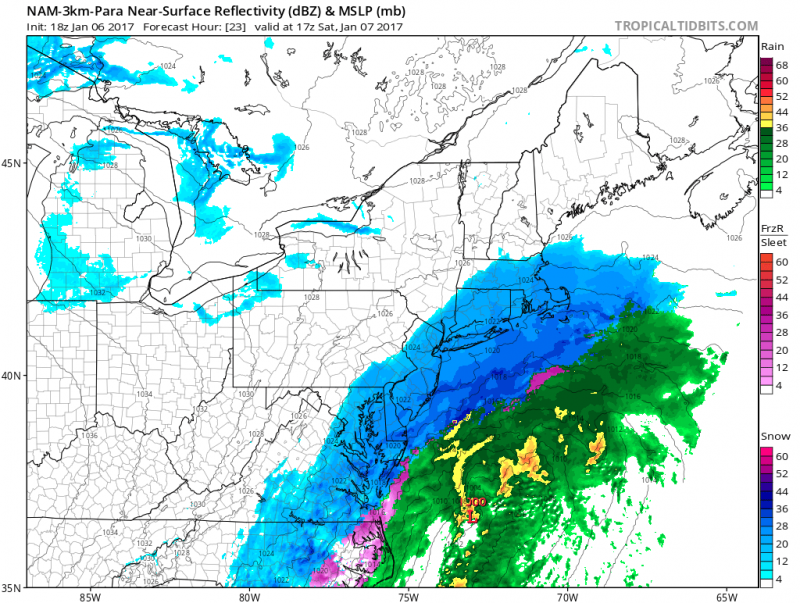 Computer model shows heaviest snow falling as storm makes its closest pass by midday. (Courtesy: tropicaltidbits.com)
With colder temperatures, the snow will be lighter, fluffy snow unlike the normal heavy wet snow we usually get. As a result, snow amounts will be higher due to fluff factor. Generally, snow to liquid ratio is 10 to 1 (10″ of snow to 1″ of liquid). In this case with colder temperatures, the ratio could be at least be 12 to 1. In this case, a .50″-.75″ liquid would equate to 6″-10″!
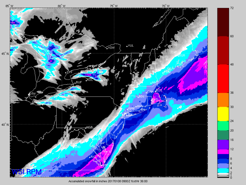 High resolution computer model shows increased amounts but not as high as Southeast VA and New England where over a 12″+ will fall. (Courtesy: WSI)
Here is the timeline of what to expect.
4AM -Light snow arrives
7AM -2PM -Brunt Of Storm-Snow, heavy at times, winds increase.
After 5PM Snow Ends, Windy with Blowing Snow
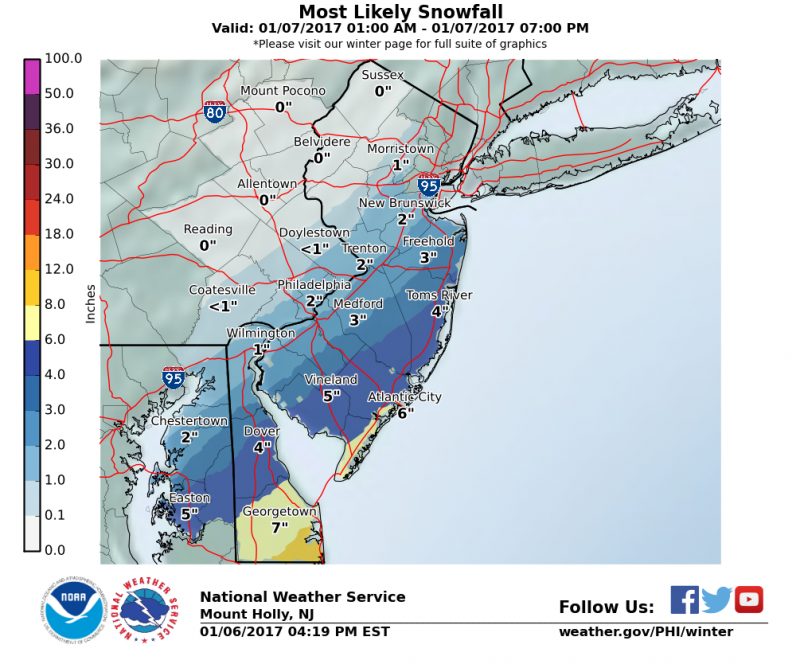
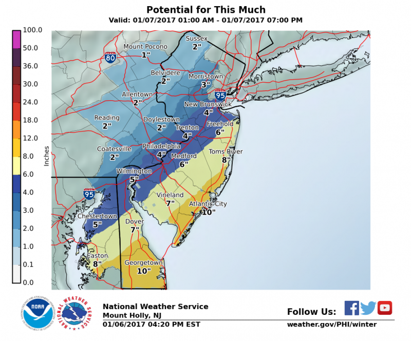
TOTAL SNOW ACCUMULATIONS 6″-10″
The maps below are from the NWS showing the most likely snowfall and worst case scenario.
