
The mainland has enjoyed temperatures in the low 70s, while the coast remained on the cooler side as a continuous southerly flow kept us in the 50s. Thanks to ocean temperatures in the low 40s. Still it has been more spring-like than winter and it looks like it will continue at least through the first half of the weekend. A strong cold front expected to arrive later on Saturday which will knock temperatures back to normal. High temperatures will be in the upper 50s Friday & Saturday with a good deal of clouds & fog.
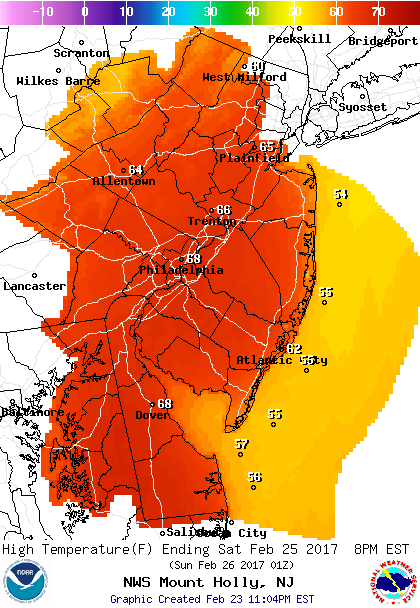 High Temperatures Saturday
The good news is that most of the weekend will be dry. The only exception will be a line of showers and possibly a t’storm ahead of the cold front Saturday evening.
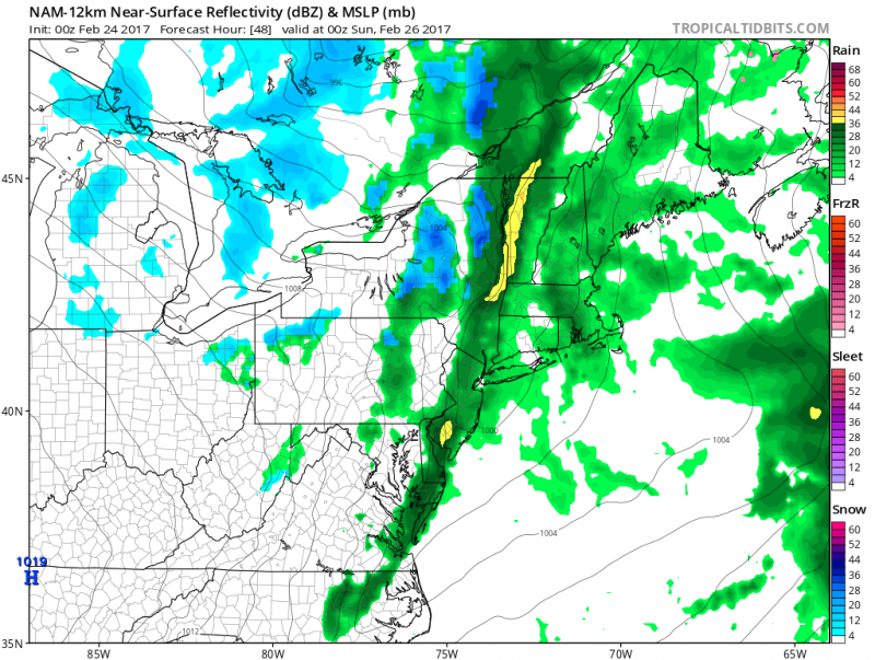 Forecast models bring a round of showers/t’storm into our area after 5pm on Saturday followed by increasing winds and dropping temperatures. (Courtesy: tropicaltidbits.com)
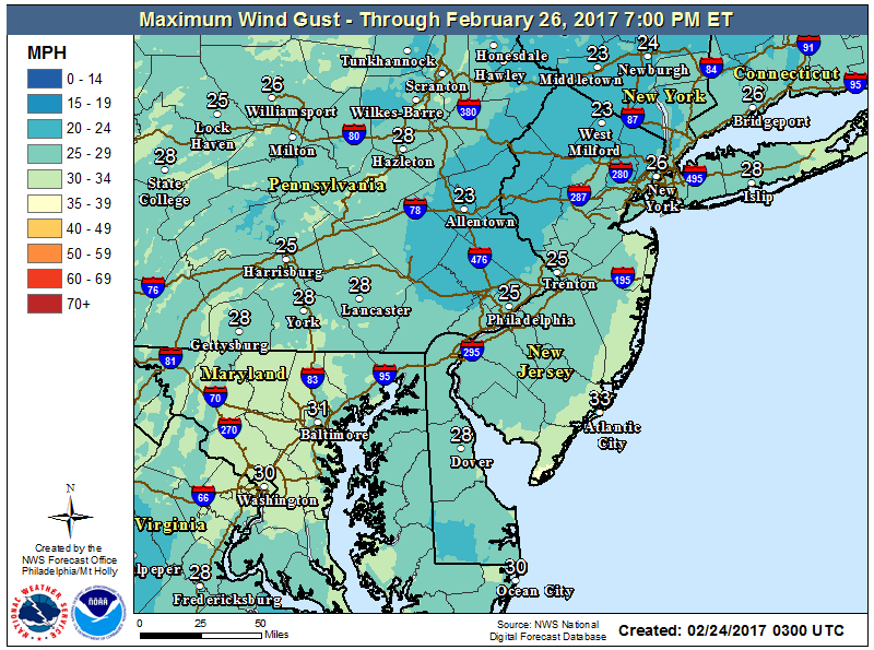 Wind gusts Saturday night-Sunday will gust 25-30mph+ behind the front with temperatures dropping into the 30s.
Bright sunshine will return on Sunday with highs in the upper 40s but brisk northwest winds will make it feel like its in the 30s.
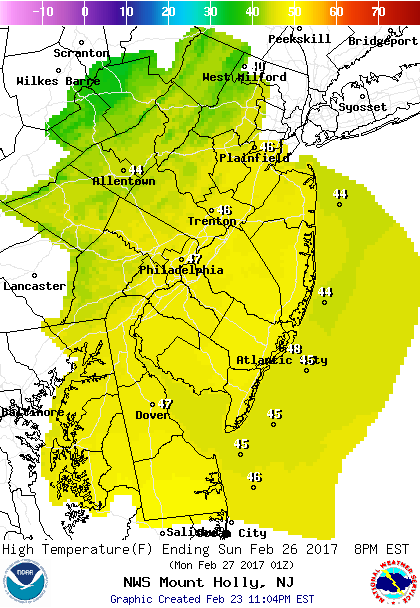 High Temperatures Sunday
Once again the cold temperatures will not last, temperatures will rebound back to the 50s next week with a couple rounds of rain expected for Tuesday and Wednesday.


