
A nasty Nor’Easter featuring heavy rain, strong winds, tidal flooding and some beach erosion will pound our area on Tuesday. Winter Storm Warnings are in effect for most of New Jersey except for Cape May County where a Winter Weather Advisory is in effect.
Rain will be heavy at times through the morning hours which will help in adding to street flooding on the islands. Temperatures will remain in the upper 30s through the event so no freezing is expected.
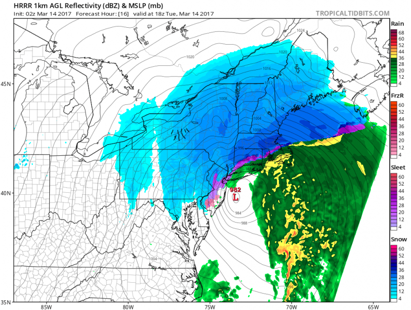
 As the storm moves by us Tuesday afternoon, colder air behind the storm could change any rain over to snow. However, most of the precipitation will be gone by then. Additional snow showers are possible the remainder of the day.
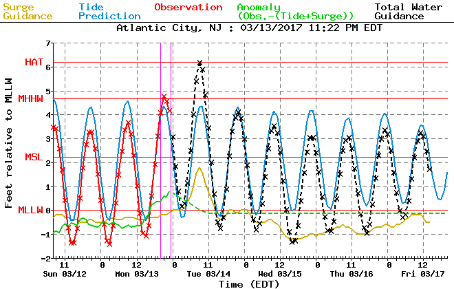
The main concern for the islands will be the tidal flooding. Moderate flooding is expected during Tuesday’s high tides. A Coastal Flood Warning is in effect as persistent onshore flow will push water into the bay causing tides to rise to near 7 feet on Tuesday morning between 10-11am. Besides the storm surge, the 1″-2″ of rain will make conditions worse. This will cause the usual roads on the islands to become impassable.
On the ocean, breakers will be 6-9 feet with waves offshore running 12-18 feet.
Tuesday evening high tide could still reach minor flooding despite winds shifting to the Northwest.
Another major factor will be the wind. A High Wind Warning until 6pm Tuesday as North winds 20-30mph with gusts up to 60 mph are possible as the storm rapidly intensifies offshore. Damaging winds could cause trees and power lines to come down causing power outages.
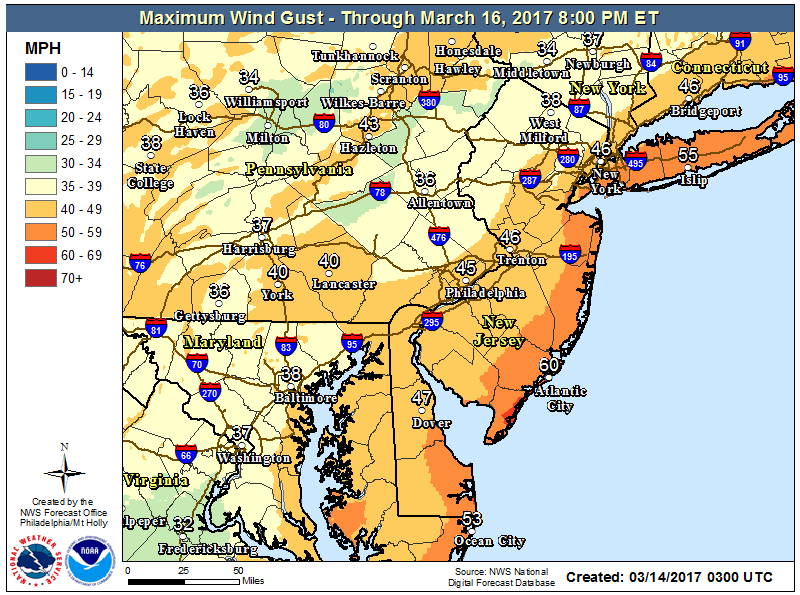 Forecast Winds Gusts show maximum wind gusts nearing 60mph right along the beaches.
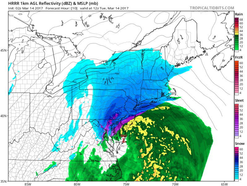
Expected snow amounts show a sharp gradient across Philadelphia into Southern NJ. For us, the track of the storm will be close enough to keep us mainly rain with only a light coating possible.
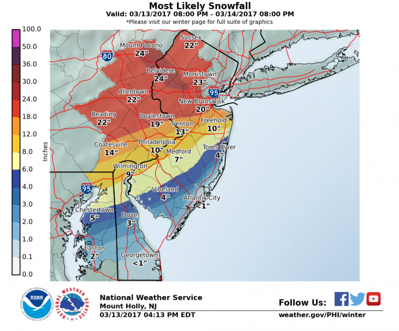 The highest totals will be over 12″+ N&W of Philadelphia where precipitation will remain all snow. Expect lesser amounts of 8″-12″ across Philadelphia and along the NJ Turnpike in South Jersey where some mixing will occur. The rain/mix line will be pushing further inland which will significantly cut down accumulations across most of Southern NJ. Snowfall amounts will remain generally run 3″-6″ across Millville, Vineland up through Toms River and 1″-3″ across most of Atlantic, Southern Ocean and Eastern Cumberland Counties.
Any rain or snow should end by late afternoon but winds will be busy until dusk. Watch out Tuesday night as any standing water could freeze as temperatures dip below freezing.


