
Flooding has been experienced at the street ends along Bay Avenue. This is expected to intensify as high tide approaches tomorrow morning 4-6a (1/24).
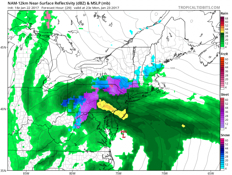
The strong coastal storm continues to pound the NJ coast. While the brunt of the storm is ending tonight, we not out of the woods yet.
High Wind Warning until Midnight
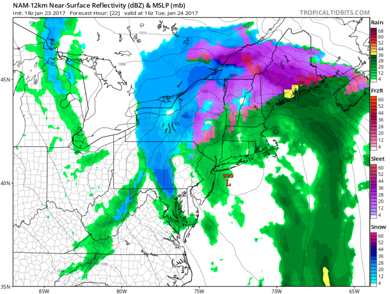
Strongest wind gusts have ended but it will continue to be windy through tonight and even tomorrow. A High Wind Warning will expire tonight as the low pressure moves north. Winds gusts still could exceed 50 mph Monday night. As the storm slowly pulls away on Tuesday, winds will still be busy from the northwest 20-25 mph with gusts over 30mph.
Coastal Flood Warning through Tuesday
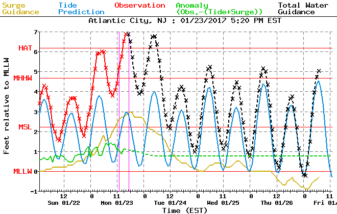
Now that we passed the highest tide of the storm, on Monday evening, we still have one more significant high tide. Monday evening high tide topped out just below 7 feet which caused moderate tidal flooding.
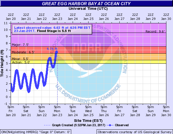
Tuesday morning high tide (4-6AM) is still expected to reach moderate flood levels, despite winds turning offshore but will not be as high as Monday evening’s tide. Fortunately, the storm hit at the right time, if the height of the storm hit on Tuesday or even later in the week when we have a New Moon, major flooding would have occurred.
Seas will slowly subside through Tuesday. Breakers along the coast, which was around 6-10 feet, will lower to 4-6 feet on Tuesday. Some beach erosion will still occur as waves continue to batter the beaches.
Rain will return overnight and Tuesday as the storm moves north & east off the coast. Expected occasional light to moderate rain through Tuesday. Rain should completely end by late afternoon.
 Sunshine returns by mid-week and will continue to stay on the mild side with highs topping out in the low 50s.


