
A brief break in our mild stretch as we move into the weekend. A strong high pressure system is building to our north sending a cold shot of air our way. While it will not be nearly as cold as earlier this week, temperatures will return to around freezing early Saturday morning. Meanwhile, a weak disturbance will slide to our south which will spread a wintry mix during the afternoon Saturday.
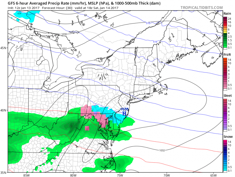 Computer models show a brief period of snow/sleet if it starts before 1pm on Saturday. (Courtesy:tropicaltidbits.com)
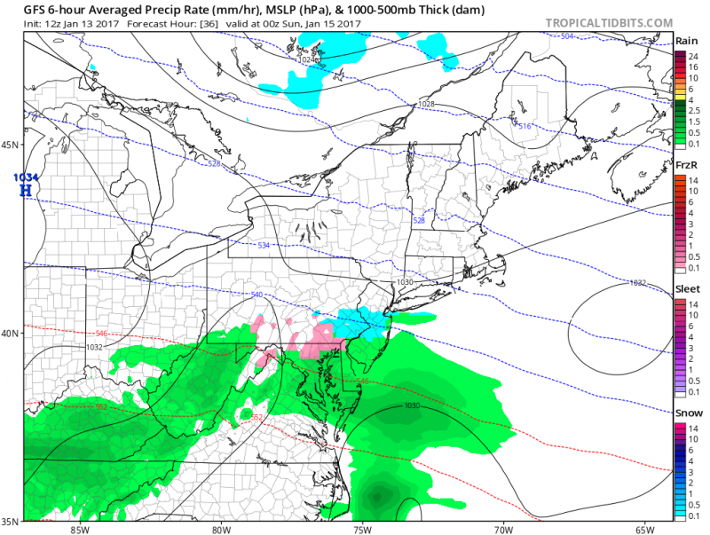
Computer models show a changeover to rain during the afternoon into evening hours on Saturday. (Courtesy:tropicaltidbits.com)
Surface temperatures will be slowly rising during the day.
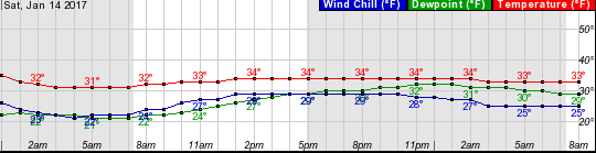 Graph shows temperatures staying above freezing during the day.
Precipitation could start as a period of snow then possibly mixing with sleet before changing to rain before ending Saturday night. Since temperatures will be above freezing during the event. Any accumulations would be on grassy areas and cars.
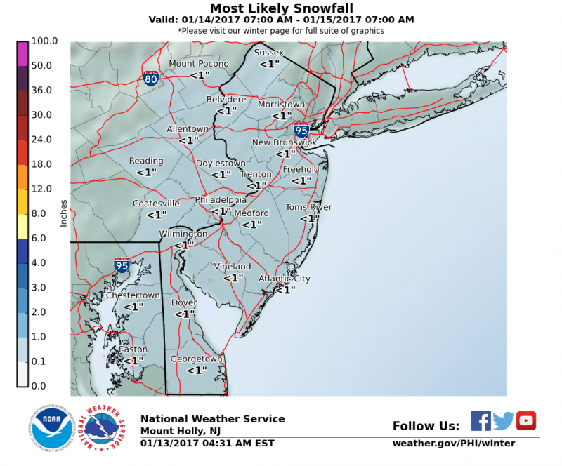 Most likely snow accumulations will be less than 1″
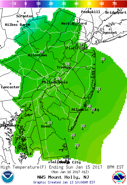
A chilly day on Sunday but it will be dry with temperatures rebounding to near 40 degrees.
 Looking ahead…milder air returns with temperatures climbing back into the 50s by mid-week and will continue through the following weekend. So any snow threat will be limited through the next 2 weeks.
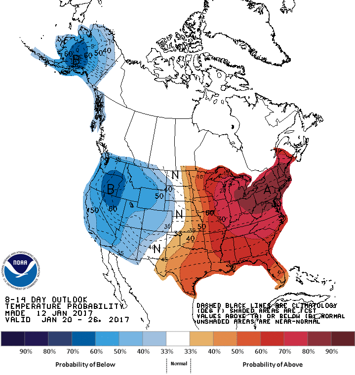 NOAA: 8-14 day outlook shows a high probability that temperatures will be above normal through January 26th.


